

- Aiea Loop Trail is located inside Keaiwa Heiau State Park at 99-1849 Aiea Heights Dr., Aiea, HI 96701. Check out the exact location on Google Maps below:
- The park in which the trail is located is open from 7 AM to 7:45 PM April 1 to Labor Day and 7 AM to 6:45 PM after Labor Day to March 31.
- Aiea Loop Trail is approximately 4.8 miles long according to the sign we saw, but my GPS tracked it at 3.8 miles, so I'm not sure where that extra mile went! It took us a little under 3 hours total to finish with lots of stops for pictures. Here's a screenshot of what the trail's path looks like:

- If you're thinking about doing this hike and it's been raining heavily, I'd advise against it. It can be very slippery and VERY muddy in many places, and your risk of falling would be much higher (not to mention the trail does pass through a stream bed at one point). The trail would probably be fine after light rain (which you can't really avoid anyways), but just be prepared for the mud by wearing proper shoes.
- Although we didn't notice any mosquitos while hiking, I would bring bug spray just in case. It's a very wooded trail (probably 90% shaded) so there's always a chance for them to be out and about. And definitely have plenty of water with you, especially if it's hot!
- This trail is dog-friendly (yay!) and I'd say relatively kid-friendly, but not stroller friendly. We saw quite a few kids when we went and they seemed to be enjoying themselves!
- See my explanation below for information on how to park!
- For more information, check out the Aiea Loop Trail page on HawaiiStateParks.org.

Aiea Loop Trail is a great hike that Mr. L and I had been itching to do for a long time. Unfortunately, it seemed like the odds were against our favor in finishing it until recently! We tried for the first time a few months ago, but it was a bad day for Mr. L and after he told me he was feeling dizzy (on the side of a MOUNTAIN, no less!), we decided to turn around for the day and let him recover. Ever since, this trail had been nagging me as our only "incomplete" trail on the island, so I knew we'd be back. Thankfully we had the opportunity a few weeks ago!


Since this is a loop trail, you can start from two ways. One way is the way Mr. L and I chose to go, which was where this sign was located -- essentially at the highest part of the road until it starts going back downhill. Unbeknownst to us, this was probably a mistake. For one, the other end of the trail is uphill and the switchbacks can be steep. That wouldn't be so bad if it weren't for the fact that the other end of the trail is actually at a lower point than this one, so if you parked up near the upper end, you'll be hiking back up the road after attacking that killer uphill portion at the end of the actual hike. If you don't mind this, that's great, but I'm going to be honest here -- I had Mr. L run up, grab the car, and come back and get me, haha! Next time we will most likely park in the same place (upper parking lot), walk down the road to the beginning of the lower end of the trail, and go backwards from the way we originally went. And if all of that was terribly confusing for you to read, I whipped up a handy little map to show you exactly what to do:

So, now that you know exactly where to park and where to start, let's get back to the trail! After parking, Mr. L and I made our way to the upper trail head and began our hike. On this day, we'd decided to bring our youngest dog with us for her very first hiking experience ever :)

Keep in mind that if you do bring your dog along, it's best to keep them leashed at all times because this area is used for boar hunting on certain days of the week. We even saw a few hunters, their hunting dogs, and a kill that they'd just made pass us on the trail. It's always best to be safe when it comes to your pup!

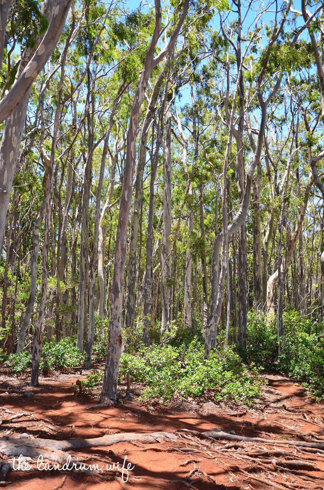
The trail itself is very well-identified and a relatively smooth walk, save for things like fallen trees and roots. As long as you're careful and watch your step, you should be fine. Or you could be like me and end up rolling your ankle because you were too busy staring at the views! (Don't worry, I was fine! Haha.) I've read that there's also an old B-24 bomber that crashed somewhere along the trail, but we didn't see it this time. Hopefully we'll catch it soon and check it out!


 |
| Click on any of the panoramas to enlarge! |

When you're almost to the midway point of the hike, you'll catch a little glimpse of the famous H3 through the trees. Don't worry, even better views are up ahead!


Now, I remember reading on Yelp that a reviewer had complained there was no real view that this trail offered. I felt like they couldn't be more wrong. At the midway point, if you step out a little bit beyond where the trail curves, you'll be greeted by this sweeping panorama of the valley below and the H3:


There was also another reason I would recommend starting at the lower trail head and taking the loop that way. When we started at the upper portion of the trail, we were immediately greeted by beautiful views of the valleys on either side of us, the ocean, and eventually the H-3. But we noticed after reaching the midway point of the trail that those views pretty much stopped. So since we walked the majority of the hike in the trees after seeing the gorgeous views, I felt a little sad (not that the forest wasn't beautiful, of course!). I likened it to having your dessert before dinner, so I personally would rather have the views as my reward for going most of the way on the hike first!


Now, a while after the midway point there will be a point in the hike, if you started at the direction Mr. L and I did, that it forks off into two different paths with a sign that says "Keaiwa Loop Trail" (I forgot to take a picture!). Take the path on the RIGHT to stay on Aiea Loop and continue on back to the parking lot. If it weren't for Yelp, I definitely wouldn't have known this, so thanks to the reviewer who mentioned it!

Overall, Mr. L and I both enjoyed this trail very much. It was a great workout for us both and a nice way to catch some views, especially that really awesome one of the H3 and the valley below. Plus it was a relatively short drive from our house, so we will definitely be checking it out a few more times while we're still here. We'd both definitely recommend it, as long as it hasn't been raining hard!
Do you enjoy hiking?
Do you enjoy hiking?


No comments:
Post a Comment